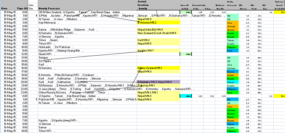
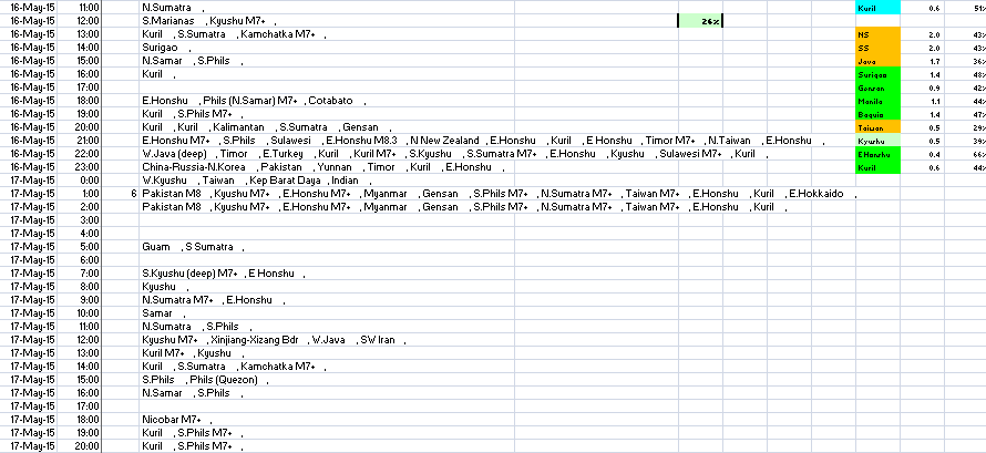
Hourly Earthquake Prediction Calendar - Yesterday Today & Tomorrow - Current Period - Asia-Pacific
Hourly earthquake forecast for Asia-Pacificfor today and tomorrow - this is derived from relative acceleration of sun and moon compared with observer location at North Sumatra. The vector sum of acceleration is correlated with previous events for the past 38 years (period of records available from USGS since 1973). The countries covered by this forecast include those in South-East and East Asia Pacific Region - such as Kamchatka, Kuril Isles, Japan (Hokkaido, Honshu, Kyushu) Izu Isles, Bonin Isles, Volcano Isles, Taiwan, Ryuku, Philippines ( Baguio, Manila, Mindoro, Batangas, Surigao, General Santos, Samar. Indonesia ( Sumatra, Java, Bali, Sumbawa, Flores, Timor, Sulawesi), China (Sichuan, Xizang, Xinjiang) Pakistan, Myanmar, Andaman, Nicobar Isles and more. The strengths shown on hourly forecast are only concerning past events so do not necessarily indicate forecast strenghts. However the forecast should act as an indicator of possible events - within a few hours. When a lot of past events in different locations are shown on the same line it does not mean that all events will occur - in fact it means that the movement is likely to be balanced so that probably less likely. The table should be viewed in conjunction with the lunar calendars for Asia-Pacific which are derived from the location of sun and moon relative to observer in N Sumatra at zero hrs GMT on each day - see table sub latitude this month. For Asia Pacific region calculations are also made concerning historic events which take account of stress transfer across tectonic plates - this is done for magnitude M6+ and M5+ - last 5 events each - also takes account of weather and lunar phase. See latest results - in this table the M5+ score highest is 2.0 which is probably most likely place for quake on the day - while percentage probability also an indicator of possible strength - thus less than 50% probably M4+, more than 50% M5+, more than 70% probably M5.5+ - but depends also on other factors - If M6+ high too more likely for big quake.

